Walk the Peddars Way and Norfolk Coast Path
A friend has invited you to do this with them.
This National Trail joins the Peddars Way, mostly sandy tracks inland from Suffolk, to a coast path past saltmarsh, mudflats, the nature reserves at Holkham and Blakeney and the birdwatching marshes at Cley. GOV.UK gives the two together as 158 miles (254 km) with gentle gradients and no stiles, about 14 days in all.
ModerateFreeA few weeksOutdoorsAlone or with othersEast of England, East Midlands
Christmas present ideas for someone who wants to walk the Peddars Way and Norfolk Coast Path
Presents that help someone get started, drawn from this page. They are ideas, not recommendations: we have not tested any of the products, so check sizes and details before you buy.
Kit to give
- BinocularsAmazon for wading birds on the marshes at Cley, Blakeney and Holkham
- Lightweight walking shoesAmazon for long, gentle miles on sandy tracks and paths
- Tide time bookletAmazon to check low water before the beach sections
Or give your company
Some of the best presents cost little: offer to go along the first time. Print a promise card to put under the tree.
Some of these are affiliate links: if you buy or book through them we may earn a commission at no extra cost to you. Amazon links are searches, so compare what comes up.
More Christmas gift ideas for people who love doing things Stocking fillers
What it's really like
The National Trail has two parts. The Peddars Way runs 46 miles (74 km) from Knettishall Heath in Suffolk, mostly on sandy tracks, to the coast at Holme-next-the-Sea. The Norfolk Coast Path is listed at 112 miles (180 km): it now runs from Sutton Bridge in Lincolnshire to the Suffolk border at Hopton-on-Sea, and signs along it may also show the King Charles III England Coast Path. GOV.UK suggests about 4 days for the Peddars Way, 10 for the coast path and 14 for both. The National Trails website gives an older total of 129.5 miles (208 km), from Knettishall Heath to Hopton-on-Sea.
Most long-distance walkers go north up the Peddars Way, then east along the coast. The coast path passes Holkham, the harbour at Wells-next-the-Sea, Blakeney and the birdwatching areas at Cley and Salthouse, then climbs onto the clifftops through Sheringham to Cromer. Erosion at Trimingham keeps moving the trail inland, and at the Winterton–Horsey dunes walkers are asked to follow diversions that protect wildlife.
GOV.UK describes gentle gradients, no stiles and some steps, and the path has been widened and levelled at Brancaster, Thornham and Skelding Hill. The trail is open all year, though the Peddars Way can flood in winter near Thorpe Woodlands, where an alternative route is signed.
Sections and ways to walk it
| Option | Distance or length | Cost (as last listed) |
|---|---|---|
| Independent, Holme (and Hunstanton) to Burnham Overy Staithe | 16.1 miles (25.9 km) | Free to walk |
| Independent, Weybourne to Cromer | 8.6 miles (13.8 km) | Free to walk |
| Norfolk Walking Holidays, Hunstanton to Cromer (45 miles) | 3-day walk | From £750 per person |
| Norfolk Walking Holidays, Hunstanton to Hopton (84 miles) | 7-day walk | From £1,300 per person |
| Norfolk Walking Holidays, Cromer to Hopton (39 miles) | 3-day walk | From £720 per person |
Norfolk Walking Holidays sells self-guided trips and does not list nights or what the price includes on its route page, so ask before booking.
How to start
- Decide whether to walk the Norfolk Coast Path alone (about 10 days) or start inland on the Peddars Way at Knettishall Heath (about 4 more).
- Check tide times before the beach sections near Cromer, Mundesley and Hopton-on-Sea.
- Plan your stages from the GOV.UK section list, and book beds early in the small coastal villages.
Where to go
- GOV.UK, Peddars Way and Norfolk Coast Path National Trail
- National Trails, Peddars Way and Norfolk Coast Path
- Norfolk Walking Holidays, Norfolk Coast Path
We opened these links on 20 November 2026 and found them to be what we say. Dates, places and prices are on the official page, where they stay up to date.
Plan this
Two ways to plan it.
Plan it yourself Free
The links you need to book it, get there, find somewhere to stay and eat, and see what else there is to do nearby. They are searches for you to run; nothing is saved.
Show the links
Plan it with dates
Pick a day, or a month, and we will set out how to get ready, step by step, with a date and a reason for each. The hard part of a day out is the timing: the right season, tickets and getting there. The plan watches the calendar for you.
Questions people ask
How long is the Norfolk Coast Path?
GOV.UK lists it as 112 miles (180 km), from Sutton Bridge in Lincolnshire to Hopton-on-Sea. With the Peddars Way the National Trail is 158 miles (254 km).
How many days does it take to walk the Norfolk Coast Path?
GOV.UK suggests about 10 days for the coast path, or about 14 if you add the Peddars Way.
Is the Norfolk Coast Path tidal?
Parts are. GOV.UK says to check tide times for the beach and clifftop sections between Cromer and Mundesley, and there is a signed high-tide alternative at Hopton-on-Sea.
Is the Norfolk Coast Path hilly?
Not much. GOV.UK describes gentle gradients, with no stiles but some steps.
Where this comes from: GOV.UK, Peddars Way and Norfolk Coast Path National Trail; National Trails, Peddars Way and Norfolk Coast Path; Norfolk Walking Holidays, Norfolk Coast Path. Opened 20 November 2026.
Read next

Dave and Judy Fox keep going back to Spain, one Camino route at a time
How a Colorado couple turned one 490-mile walk across Spain into a habit of returning for new Camino routes; why the Camino keeps getting busier; and how to train for walking day after day with a pack.
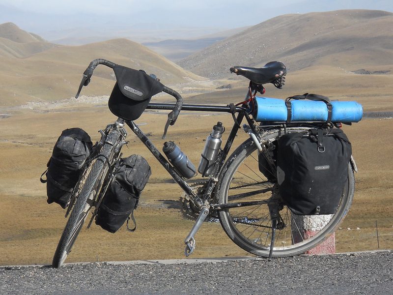
Bangkok to Bangkok the long way: Mark Herbst's 30,000 km ride for Jackie
How Mark Herbst, a cycling coach from Ontario, rode 30,000 km around the world in 324 days in memory of his wife, raised money for cancer research and took a Guinness World Record; and how to build towards a cycle tour of your own, from a first overnight trip to a fortnight on the road.
More like this
Gentle
See grey seal pups on the coast
Gentle
Go on a guided bird walk
Gentle · East of England
Paddle a canoe trail on the Norfolk Broads
Demanding
Walk a National Trail from end to end